Surveying is a fundamental discipline in civil engineering that supports planning, design, and execution of infrastructure projects. It involves the measurement of distances, directions, and elevations to determine the relative positions of points on or near the Earth’s surface. When angular measurement is required without sophisticated instruments, compass surveying is commonly adopted.
What is Compass Surveying?
Compass surveying is a method of surveying in which the directions of survey lines are measured using a magnetic compass, while linear measurements are taken using a chain or tape. The bearings of lines are measured with respect to the magnetic meridian.
In this method:
- Angular measurements are obtained from a compass.
- Linear measurements are taken by chain or steel tape.
- The traverse method is generally adopted.
The measured bearings may be expressed in:
- Whole Bearing System (WBS) – Bearings measured clockwise from the north, ranging from 0° to 360°.
- Quadrantal Bearing System (QBS) – Bearings measured from north or south toward east or west (e.g., N 30° E).
When Compass Surveying is Preferred
Compass surveying is generally preferred under the following conditions:
- When surveying large areas such as coastal regions or river courses.
- When the area contains obstacles that make chain surveying or triangulation difficult.
- When moderate accuracy is acceptable and time is limited.
- For preliminary surveys and route surveys (roads, canals, pipelines).
Limitations of Compass Surveying
Compass surveying has several limitations due to its dependence on the Earth’s magnetic field:
- Not suitable in areas with magnetic disturbances.
- Affected by iron ore deposits, steel structures, and electric cables carrying current.
- Subject to local attraction errors.
- Less accurate compared to theodolite surveying.
Types of Compass
Compasses can be broadly classified as follows:
- Magnetic Compass
- Prismatic compass or Lensatic compass
- Surveyor’s compass
- Liquid compass
- Marine compass or Card compass
- Baseplate compass or Orienteering compass
- Thumb compass
- Solid-state compasses
- Qibla compass
- GPS Compass
- Gyro Compass
- Astro Compass
Compasses Used in Surveying
The main types of compasses used in surveying practice are:
- Prismatic compass
- Surveyor’s compass
- Level compass
Magnetic Compass
A magnetic compass consists of a magnetized needle that aligns itself with the Earth’s magnetic field. It indicates the magnetic north-south direction.
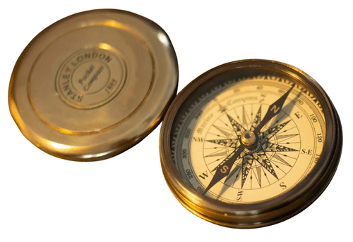
Fig-1: Magnetic Compass
The magnetic bearings of lines are determined with reference to magnetic meridian. Accuracy depends on the stability of the needle and absence of magnetic interference.
Prismatic Compass (Lensatic Compass)
The prismatic compass is widely used in traverse surveying. It consists of:
- A circular graduated ring attached to a magnetic needle.
- A prism for magnified reading.
- Sighting vanes for alignment.
The observer can simultaneously sight the object and read the bearing through the prism. Bearings are measured in the Whole Bearing System.
In a closed traverse:
- Fore bearing (FB) and back bearing (BB) of a line should differ by 180° if local attraction is absent.
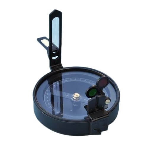
Fig-2: Prismatic Compass
Surveyor’s Compass
The surveyor’s compass measures bearings in the Quadrantal Bearing System. In this instrument:
- The graduated ring is fixed.
- The magnetic needle moves independently.
- Mounted on a tripod with leveling arrangement.
It is suitable for moderate precision surveys but less accurate than a theodolite.
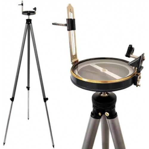
Fig-3: Surveyor Compass
Liquid Compass
A liquid compass contains a magnetized needle or compass card suspended in a liquid such as alcohol or mineral oil. The liquid:
- Reduces oscillation of the needle.
- Improves stability and readability.
Fig-4: Liquid Compass
Marine Compass (Card Compass)
In marine compasses, the compass card rotates in fluid while the needle remains fixed. The fluid damping minimizes the effect of vessel motion, making it suitable for navigation at sea.
Fig-5: Marine Compass
Baseplate (Orienteering) Compass
This is a liquid-filled compass mounted on a transparent base plate. It includes:
- Map-reading scale.
- Magnifying lens.
- Direction-of-travel arrow.
Fig-6: Baseplate Compass
Thumb Compass
A smaller version of the baseplate compass, fixed to the thumb. It allows one hand to remain free and is commonly used in orienteering.
Fig-7: Thumb Compass
Solid-State Compass
Solid-state compasses use electronic magnetic sensors and microprocessors to detect orientation. They are used in smartphones, tablets, and digital navigation devices.
Fig-8: Solid State Compass
Qibla Compass
This compass is used to determine the direction of Mecca (Qibla). It operates on magnetic principles.
Fig-9: Qibla Compass
GPS Compass
A GPS (Global Positioning System) compass determines direction using satellite signals. It calculates position (latitude, longitude, altitude) and determines heading based on multiple antenna readings.
It is independent of magnetic interference and provides high positional accuracy.
Fig-10: GPS Compass
Gyro Compass
A gyro compass operates on the principle of gyroscopic motion and Earth’s rotation. It indicates true north rather than magnetic north. It is widely used in ships and aircraft navigation.
Fig-11: Gyro Compass
Astro Compass
An astro compass determines true north using astronomical bodies such as the sun or stars. It is particularly useful in polar regions where magnetic and gyro compasses become unreliable.
It requires:
- Accurate time.
- Latitude and longitude.
- Known astronomical position.
Fig-12: Astro Compass
Compass surveying is suitable for preliminary and route surveys where moderate accuracy is acceptable. However, for high-precision engineering projects, advanced instruments such as theodolites and total stations are preferred. Understanding the principles, types, and limitations of compasses is essential for civil engineering students and professionals.